Quick summary: Discover how farm mapping solutions are transforming Tanzania’s smallholder agriculture. Digitize plots, enhance traceability, ensure compliance, and unlock market access for cocoa, cashew, ginger, hibiscus, and sesame farmers.
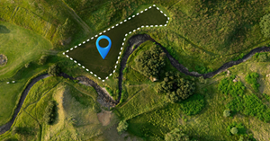
Farm Mapping in Tanzania is the process of digitally capturing and verifying smallholder plot boundaries using GPS, satellite imagery, and geospatial tools. It enables accurate identification of farm size, location, land use, and crop activity across fragmented smallholder landscapes. By digitizing plots, Farm Mapping in Tanzania improves traceability, supports land-tenure clarity, strengthens sustainability and deforestation-free compliance, and enables access to formal markets and climate-smart programs. This data foundation is increasingly essential for supply chain transparency, farmer inclusion, and regulatory readiness in agriculture-driven export sectors.
Smallholder farmers are the foundation of Tanzania’s agricultural sector, accounting for over 65–70% of total agricultural output and employing the majority of the rural population. Most smallholders operate on small, fragmented plots averaging 1–3 hectares, often without formally documented or digitally mapped land boundaries. This limited farm-level visibility creates challenges for buyers, financial institutions, development programs, and processors that require accurate data for sourcing, credit assessment, and compliance with global sustainability standards.
Land tenure remains a key constraint. While Tanzania has a structured village land system, many farmers cultivate land under customary or informal arrangements, with incomplete records, unclear boundaries, and limited geospatial documentation. As a result, many smallholders face barriers to long-term investment, formal financing, and participation in traceable supply chains.
Tanzania’s diverse agro-ecological zones support a wide mix of crops. Nationally significant crops include maize, rice, cassava, beans, sorghum, millet, sunflower, coffee, tea, cotton, cashew nuts, tobacco, and horticulture. Regional specialization is well defined coffee in Kilimanjaro and Mbeya, tea in the Southern Highlands, cashew in the Southern Coastal regions, cotton around Lake Victoria, and maize and rice across much of the country.
These structural gaps fragmented landholdings, limited plot documentation, and low digital visibility—highlight why digital farm mapping is becoming critical to improving productivity, enabling financing, strengthening traceability, and integrating millions of Tanzanian smallholders into modern, compliant value chains.
Ensure regulatory readiness and traceable sourcing with smart farm mapping. Learn how mapping every plot can streamline compliance and reduce risk across your supply chain.
[Explore the Blog →]
Digitally profile farmers to capture verified data, improve traceability, and strengthen ESG and sustainability reporting. Discover how digital onboarding empowers both farmers and buyers.
[Read the Blog →]
Digitizing smallholder farms with GPS coordinates, mapped plot boundaries, and verified farmer identities enables more accurate delivery of inputs and government support. In Tanzania, fertilizer subsidies, seed distribution programs, and mechanization schemes often face challenges related to inaccurate farmer registries and plot size estimation. With digitized plots, authorities and agribusinesses can:
Limited access to finance remains a major barrier for Tanzanian smallholders, largely due to informal land tenure and lack of verifiable farm data. Digitized plots enable:
Tanzania faces increasing climate variability, including droughts in central regions, flooding in river basins, and shifting rainfall patterns. Digitized farm plots allow:
Tanzania’s agricultural exports—coffee, cashew nuts, cotton, tobacco, tea, spices, and sesame—totaled $2.9 billion in Q4 2024 alone, up from $2.3 billion in 2023 (+9.5% YoY), with traditional cash crops comprising ~80% of overall exports amid tightening EU EUDR deforestation-free requirements. Coffee earnings surged 66.3% YoY to $227.9 million (41.38% increase), tobacco hit $340.41 million (+90.68% and +32% export value), cashew nuts reached $2.3 billion potential (1.05 million tons May 2025), while cotton stood at $170 million (94,600 tons) and sesame contributed to horticultural/spice gains alongside tea and cloves. Digitized farm plots deliver verified origin/land-use history and end-to-end traceability, slashing EU shipment rejection risks (critical as 17% of forex historically from coffee) and bolstering competitiveness in high-value markets, protecting farmers/exporters from disruptions as regulations intensify

Farm mapping in Tanzania combines GIS tools, mobile data collection, remote sensing, and where required high-resolution drone surveys to digitally map smallholder plots with accurate and verifiable geolocation. Each farm receives a unique digital identity that supports traceability, access to finance, climate-risk monitoring, and participation in government and export programs.
Capturing polygon boundaries: Enumerators, extension officers, or cooperative agents walk the perimeter of each farm using GPS-enabled mobile apps. Latitude–longitude points are recorded and converted into polygon boundaries that define plot size, shape, and exact location. This reduces land-boundary disputes and enables precise acreage-based planning.
Mobile data collection tools: Digital platforms collect farmer profiles, crop types, planting seasons, input usage, soil indicators, and geo-tagged photos. Offline functionality is essential for rural Tanzania, where connectivity can be intermittent, with data syncing automatically once a network is available.
NDVI vegetation analysis: Satellite-derived NDVI data is used to monitor crop vigor, canopy cover, and stress across large farming zones. This allows government agencies, agribusinesses, and buyers to assess farm health remotely and at scale.
Crop classification & stress detection: Machine-learning models identify dominant crops such as maize, rice, sunflower, cotton, coffee, cashew, and horticulture, while flagging risks like drought stress, nutrient deficiencies, and pest or disease outbreaks. This supports production forecasting and early intervention.
Coffee, cashew, tea, cotton, and horticulture clusters: Drones provide centimeter-level imagery for plantation and high-value crop systems, enabling accurate tree counts, age profiling, canopy density analysis, and yield estimation—critical for export-oriented crops such as coffee, tea, cashew, and specialty horticulture.
Plant health insights: Multispectral drone sensors capture chlorophyll levels, water stress, and disease spread with greater precision than satellites. This supports precision agriculture, reduces input waste, and strengthens sustainability compliance for exporters and organized buyer groups.
Farm mapping in Tanzania creates a reliable digital foundation for agriculture turning smallholder plots into verifiable, traceable, and finance-ready assets that connect farmers to markets, climate programs, and modern value chains.
Northern and central regions form Tanzania’s primary staple-producing zones, with expansive smallholder landscapes supporting national food security. Key states include Arusha, Manyara, Kilimanjaro, Dodoma, Singida, and Tabora.
Key focus crops include:
Mapping priorities: large-scale acreage verification, yield forecasting, input targeting, and climate-risk monitoring in drought-prone zones.
The Southern Highlands are Tanzania’s most productive and export-oriented agricultural regions, including Mbeya, Njombe, Ruvuma, Iringa, and Songwe.
Key crops include:
Mapping priorities: traceability for export crops, certification readiness, productivity benchmarking, and land-use verification.
Coastal and southern regions such as Lindi, Mtwara, Pwani, and Morogoro support major tree-crop and cash-crop systems.
Key crops include:
Mapping priorities: farm-level traceability, EUDR and sustainability compliance, smallholder aggregation, and export readiness.
The Lake Victoria basin including Mwanza, Shinyanga, Simiyu, Mara, and Geita is a densely farmed region with mixed cropping systems.
Major crops include:
Key characteristics:
Farm mapping is increasingly essential across Tanzania’s agricultural ecosystem, supporting stakeholders that rely on accurate, geotagged farm data:
Regional farm mapping in Tanzania enables smarter planning, stronger traceability, and deeper integration of smallholders into resilient, export-ready agricultural value chains.
While farm mapping is becoming essential for productivity, finance, and traceability in Tanzania, several structural and on-the-ground challenges must be addressed to scale it effectively and inclusively.
1. Informal and Fragmented Land Tenure
Although Tanzania operates under a village land governance system, many smallholders cultivate land based on customary or informal arrangements. Plot boundaries are often inherited, verbally defined, or seasonally adjusted, making precise mapping difficult. Conflicting claims and lack of updated land records can discourage farmers from participating due to fear of land disputes or exclusion.
2. Small, Scattered, and Intercropped Plots
Most Tanzanian smallholders farm plots averaging 0.5–3 hectares, frequently spread across multiple locations. Intercropping common in maize–legume, cassava–bean, or agroforestry systems makes crop classification and boundary delineation more complex than in monocropped systems.
3. Limited Digital Literacy and Trust Barriers
Many farmers have limited exposure to digital tools and may be unfamiliar with GPS mapping, mobile apps, or data-sharing concepts. Concerns around land security, taxation, or misuse of data can reduce participation unless mapping programs are paired with strong community engagement and transparency.
4. Connectivity and Infrastructure Constraints
Rural connectivity remains uneven, with many farming areas experiencing poor mobile network coverage and limited electricity access. Farm mapping solutions must therefore support offline data collection, delayed synchronization, and low-power devices—raising implementation complexity and cost.
5. Environmental and Climatic Limitations
Seasonal cloud cover, especially in the Lake Zone and Southern Highlands, can reduce satellite image quality. Flooding in river basins and coastal areas can alter plot boundaries seasonally, complicating temporal consistency in maps and land-use records.
6. Cost and Scalability Challenges
High-resolution satellite imagery, drones, skilled enumerators, and data validation processes require significant investment. Scaling farm mapping nationwide demands cost-efficient models that balance accuracy with affordability, especially for donor-funded and government-led programs.
7. Data Governance and Interoperability Gaps
Farm mapping initiatives are often conducted in silos by different projects, NGOs, or buyers, leading to fragmented datasets that cannot be easily shared or reused. Lack of common data standards and governance frameworks limits interoperability and long-term value.
Tanzania’s farm mapping challenge is not technical alone it is institutional, social, and operational. Overcoming these barriers requires trusted engagement with farmers, interoperable digital systems, supportive land policies, and scalable implementation models that prioritize inclusion as much as accuracy.
The TraceX Farm Management Platform delivers an end-to-end digital infrastructure to accurately map, profile, and monitor smallholder farms across Tanzania’s diverse agricultural landscapes from the Lake Zone and Southern Highlands to coastal and corridor-based production belts. It is purpose-built to support governments, NGOs, exporters, cooperatives, and financial institutions with reliable, real-time farm-level data.
TraceX enables field teams, extension officers, and cooperatives to capture precise farm boundaries using GPS-enabled polygon mapping via a mobile app. Each plot is registered with accurate geolocation, essential for subsidy targeting, sourcing programs, and compliance with export and sustainability requirements.
Every mapped plot is linked to a structured farmer profile capturing demographics, farm size, crops grown (maize, rice, coffee, cotton, cashew, horticulture, etc.), input usage, and production history. Optional identity and cooperative membership verification strengthen trust for lenders, buyers, and development programs.
TraceX integrates satellite-derived analytics such as NDVI to monitor crop health, stress patterns, and growth cycles. These insights support climate-resilience planning, targeted advisory, yield forecasting, and early intervention, particularly critical in drought- and flood-prone regions.
The platform secures farm location data, production records, and sourcing movements on blockchain, ensuring tamper-proof traceability. This enables Tanzanian exporters to demonstrate deforestation-free sourcing and meet stringent EU and global standards for commodities such as coffee, cashew, cocoa, sesame, and spices.
TraceX digitally connects farmers to aggregators, processors, cooperatives, and exporters, creating full transparency across the value chain. Stakeholders gain verified visibility into origin, practices, and volumes, reducing risk, improving planning, and unlocking premium markets.
Farm Mapping in Tanzania is no longer just a technical upgrade it is a strategic necessity for inclusive growth, sustainable production, and global market access. By digitizing smallholder plots with precise geolocation and verifiable data, Tanzania can strengthen land transparency, unlock finance for farmers, improve climate resilience, and meet rising traceability and sustainability expectations from global buyers. As regulations, climate risks, and competitive pressures intensify, accurate farm-level mapping will define which value chains remain export-ready and which smallholders are fully integrated into the future of agriculture.
Unlock the full potential of your farm! Explore our comprehensive guide to farm management and discover strategies to boost productivity, streamline operations, and enhance traceability.
Digitize your farm for a sustainable future! Learn how farm management software can help smallholders and agribusinesses monitor crops, ensure compliance, and meet global sustainability standards.
See your farm like never before! Discover how GIS technology is transforming agriculture with precise farm mapping, crop monitoring, and data-driven decision-making for higher efficiency and traceability.
Farm mapping involves digitally capturing the location, boundaries, and details of smallholder plots using GPS or GIS tools to improve traceability and compliance.
It helps verify land access, monitor crop production, ensure compliance with export regulations, and strengthen access to premium global markets.
Key export crops such as cocoa, cashew, ginger, hibiscus, and sesame benefit significantly from plot-level digitization for traceability and quality monitoring.
Digitized farm data allows verification of environmentally responsible practices, deforestation-free sourcing, and ethical smallholder engagement.
Yes. By providing verifiable origin data, farm mapping increases buyer confidence, reduces compliance risks, and helps exporters meet international standards.


