EUDR for Smallholders: How to Collect Compliant Field Data at Scale
Published
, 13 minute read
Share this article
Quick summary: Learn how to collect EUDR data from smallholder producers, including geolocation coordinates, legality documents, and traceability records required for compliant Due Diligence Statements.
EUDR for smallholders means operators must collect GPS geolocation (polygon for plots >4 ha, single point for <4 ha), proof of legal land-use rights, and deforestation-free verification against the 31 December 2020 cut-off for every smallholder plot then compile it into a Due Diligence Statement (DDS) filed in the EU Information System before goods enter the EU market.
The obligation sits with operators and traders, not individual farmers but operators cannot comply without smallholder data. For supply chains with hundreds or thousands of farmers, offline-first mobile capture, cooperative-based onboarding, and automated DDS generation are the only pathways that scale.
Collecting EUDR for smallholders data is not a spreadsheet exercise it is a supply-chain infrastructure problem. If you source through smallholder-dominated regions (West Africa for cocoa, Southeast Asia for palm oil and rubber, India or Ethiopia for coffee), you already know what is coming: every plot, every farmer, every season geolocated, verified, and filed in a Due Diligence Statement before your cargo reaches the EU.
The question is no longer whether you must comply. It is whether you can actually collect the data from a fragmented, low-connectivity, multilingual farmer base. This guide shows you how updated for the 2026 simplification package.
Key Takeaways
EUDR for smallholders requires GPS coordinates (polygon >4 ha, single point <4 ha), land-tenure records, and deforestation-free verification from every plot in your supply chain.
With smallholders producing an estimated [80%+] of global cocoa and only [29%] internet access across Sub-Saharan Africa, offline-first mobile tools and cooperative-based onboarding are the only scalable compliance pathways.
The full pipeline field capture, satellite validation, DDS auto-generation, and Information System submission can be automated, cutting compliance preparation time by [up to 80%].
The 2026 simplification package added a one-time simplified declaration for micro/small primary operators in low-risk countries a real concession for smallholders, but it does not remove the need for plot geolocation.
Why EUDR for Smallholders Is So Hard
EUDR for smallholders is the compliance bottleneck few operators prepared for. Three structural barriers make it uniquely difficult:
Fragmentation. Unlike commercial plantations, smallholder farms are scattered across villages and districts, often with no digital footprint. Data moves through layers of aggregators and traders each step losing traceability.
Connectivity. Field data collection in remote regions cannot rely on a live internet connection, yet most enterprise tools were never designed for offline-first operation.
Language and literacy. Onboarding farmers across West Africa, India, or Indonesia spans multiple local languages and varying digital literacy a barrier generic SaaS platforms systematically ignore.
29% of Sub-Saharan Africa has internet access making standard cloud-based data tools unusable in the field.
What EUDR Requires from Each Smallholder Plot
The regulation is precise on geolocation: plots larger than 4 hectares need a GPS polygon (multiple boundary coordinates); plots under 4 hectares need a single GPS coordinate. Beyond coordinates, every smallholder plot needs:
Land-tenure records — proof of legal land-use rights.
Production data — commodity type, harvest volume, season.
Deforestation-free status — verified against the 31 December 2020 cut-off date.
Legality compliance — labour rights, Free, Prior and Informed Consent (FPIC), and environmental-protection documentation.
From due diligence and geolocation to legality verification and risk assessments, discover the key requirements businesses must meet before placing products on the EU market.
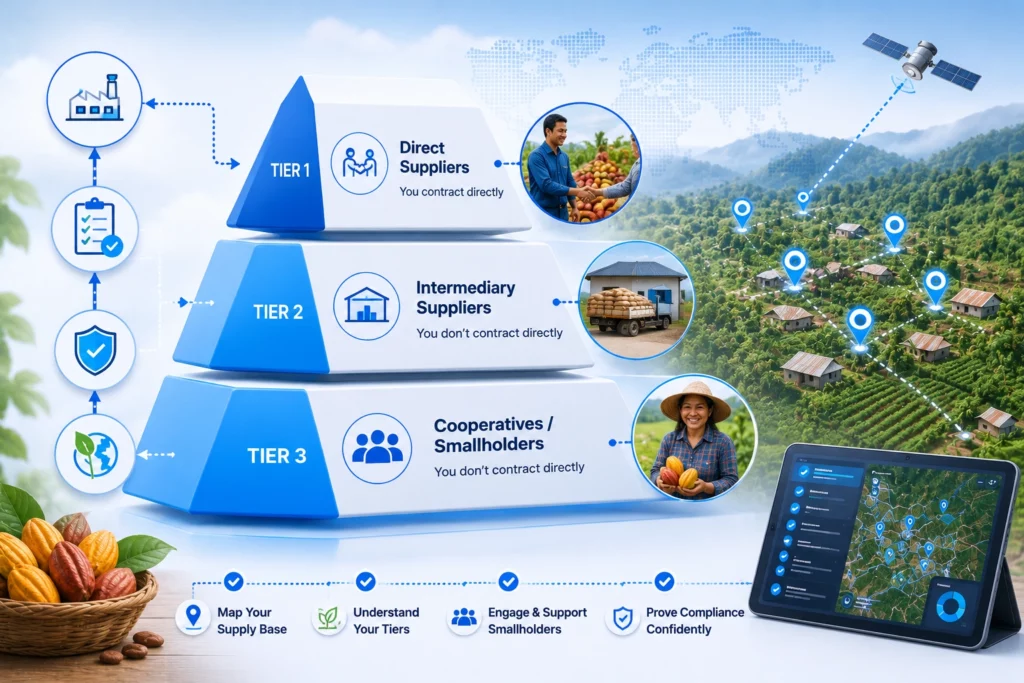
Tier your smallholder supply chain before collecting a single data point skipping this duplicates effort and leaves high-risk pockets undocumented.
Tier 1 (Direct): Farmers or cooperatives you contract with directly — highest data control, start here.
Tier 2 (Intermediary): Aggregators and traders who blend from multiple sources — highest deforestation risk, hardest to trace.
Tier 3 (Cooperative/Association): Farmer groups with internal data systems — best scale leverage.
~[60%] of cocoa from Côte d’Ivoire is indirectly sourced or of unknown origin — moving through intermediaries who break the traceability chain.
Prioritise Tier 2 geographies first they are your highest-risk pockets and most likely audit-failure points. Identifying them before you deploy field teams saves months of wasted effort.
Step 2: Build Field-Ready Data Collection for Smallholders
Most EUDR smallholder programs fail here tools that need stable internet, an English UI, and a smartphone the farmer does not own never bring data in.
Offline-First Is Non-Negotiable for Smallholders
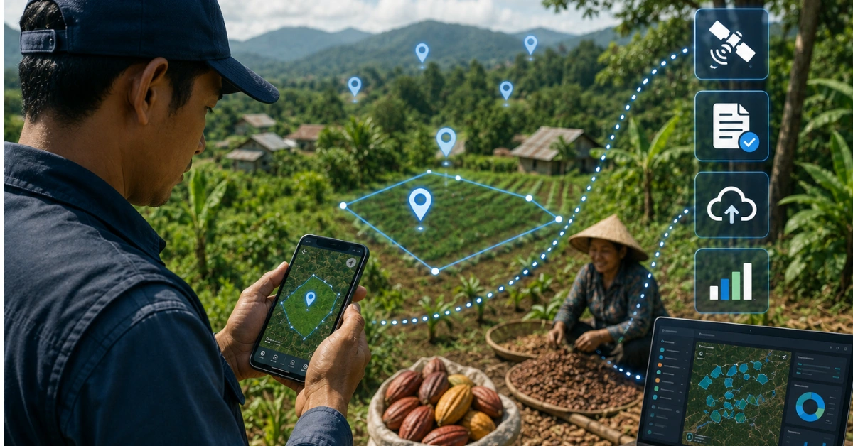
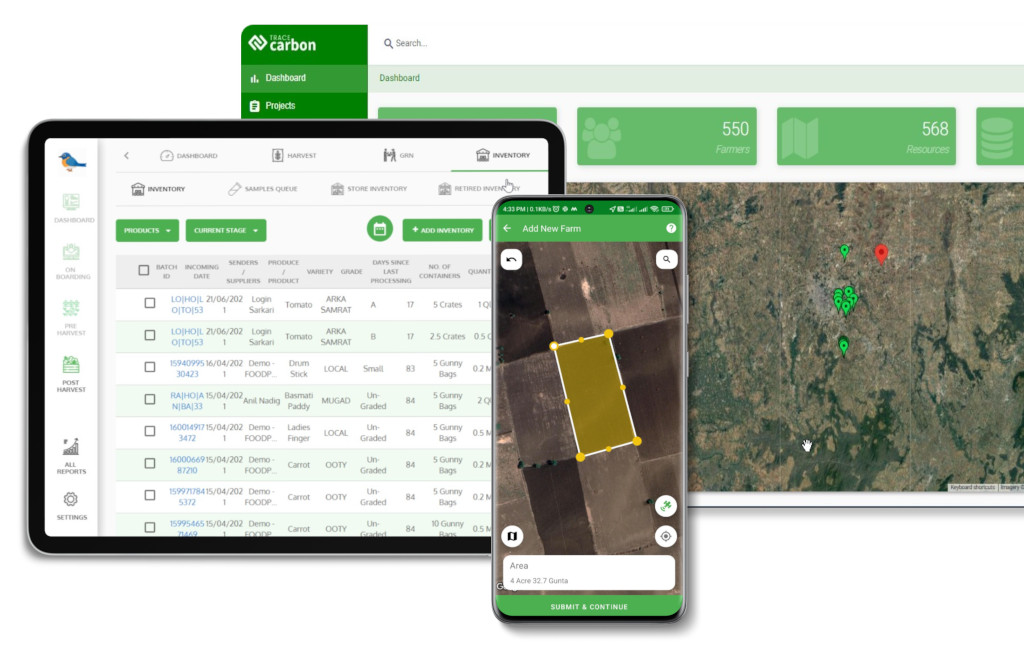
Field agents must be able to capture GPS coordinates, photograph land records, and register farmer profiles in zero-connectivity areas syncing when a signal returns. This is how TraceX’s mobile field app operates across sourcing programs in India, Africa, and Southeast Asia: captured fully offline, auto-synced when connectivity resumes.
See How TechnoServe Enabled Farm Management in Low-Connectivity Regions
Discover how offline mapping, seamless data synchronization, and digital farm management helped TechnoServe improve field operations, strengthen compliance, and enhance farmer engagement.
Your tool must handle both polygon (>4 ha) and single-point (<4 ha) formats and flag when polygon capture is required based on plot size. AI-powered document parsing — built into TraceX’s compliance platform automatically extracts KYC, land-tenure, and certification data from scanned supplier documents, eliminating manual entry.
Step 3: Onboard Smallholder Farmers Without Losing Them
One-line summary: The failure mode here is relational, not technical without trusted village-level communication, farmers disengage before a single data point is captured.
Over [70%] of smallholder farmers in cocoa supply chains are unaware of EUDR requirements, or believe compliance only applies to large commercial farms.
Use the Cooperative Structure to Onboard Smallholders
Some cooperatives already hold geotagged data for every member. Those that don’t are still the fastest onboarding channel trusted relationships already exist, and collection can be coordinated centrally through cooperative field officers rather than farm-by-farm. The agent model (training local representatives to run mobile tools) is the only approach that scales in low-connectivity, multilingual environments.
How to Handle Smallholder Language and Literacy Barriers
Multilingual interface support is the difference between a farmer engaging and walking away. Tools should offer local-language interfaces for field agents and voice-assisted workflows for low-literacy farmers. FPIC must be documented in a language the farmer understands EU competent authorities require demonstration that FPIC principles are upheld, making it both an ethical and a legal requirement.
Step 4: Validate Smallholder Field Data Against Satellite Benchmarks
Raw GPS data is not EUDR-compliant data it becomes compliant only when cross-checked against authoritative satellite deforestation datasets.
EUDR recognises the Joint Research Centre (JRC) Global Forest Cover dataset and the Hansen / Global Forest Watch GLAD alerts as reference sources. TraceX’s EUDR Solutions runs this automatically: polygon data is cross-referenced against datasets to generate a plot-level risk score, and high-risk plots trigger review before entering the DDS workflow.
When a plot fails validation: document the result, flag the supplier, and start a corrective-action process. A failed satellite check is not automatically a compliance failure it is a trigger for deeper investigation. Documented due diligence on a flagged plot often satisfies auditors more than no record at all.
EUDR compliance requires more than identifying forest loss—it requires evidence you can confidently present during audits. Learn how to combine geospatial intelligence, supplier data, and risk analysis into an audit-ready assessment.
Read our Complete Guide to Audit-Ready Deforestation Risk Assessments
Step 5: Turn Smallholder Data Into a Compliant DDS
This is where data collection becomes compliance verified plot data is compiled into a Due Diligence Statement and filed in the EU Information System for a reference number.
Manual DDS compilation from spreadsheets is where programs collapse. A single exporter with 2,000 smallholder sources needs 2,000 verified records reconciled by shipment lot, season, and commodity. TraceX’s AI-powered DDS generation compiles verified field data, satellite results, land-tenure records, and KYC automatically into EU Information System (TRACES)-ready submissions, with one-click export to PDF, XML, or CSV and a full audit trail.
The EU Information System is central to EUDR compliance. Learn how to register, prepare your data, submit Due Diligence Statements, and navigate the latest system updates with confidence.
What the 2026 Simplification Package Changes for Smallholders
The Commission’s 4 May 2026 package did not move the deadline but it created a lighter compliance path for the smallest operators.
No further delay. EUDR applies from 30 December 2026 for large and medium operators (and micro/small operators in the timber sector), and from 30 June 2027 for micro and small operators outside timber, under Regulation (EU) 2025/2650.
A one-time simplified declaration. Micro and small primary operators in low-risk countries can now file a single simplified declaration in the Information System instead of a DDS per consignment a meaningful concession for smallholders and family farms where precise polygon data is hard to obtain. It is updated only when their situation materially changes.
Information System support. The system reopened in 2026 and now supports the simplified declaration (including via API), new downstream-operator registration categories, and voluntary grouping of DDS reference numbers.
What did NOT change. Core obligations stand: operators still need plot geolocation, proof of legality, risk analysis and mitigation, and a DDS for products first placed on the EU market. The simplified declaration reduces filing burden — it does not remove the need to collect smallholder plot data.
The latest EUDR simplification measures streamline certain compliance processes but they don’t change the core obligations. Learn what’s changed, what hasn’t, and how to prepare with confidence.
Pathway 1: Certification as Risk-Mitigation Support
EU-recognised third-party certifications Rainforest Alliance, Fairtrade, RSPO, FSC can support risk mitigation and reduce the due-diligence burden for lower-risk sourcing, particularly for Tier 3 cooperatives. They do not replace geolocation, plot-level evidence, or the DDS obligation they sit alongside them.
From FSC and PEFC to RSPO and other certification schemes, understand how certifications support EU sustainability regulations and where additional compliance obligations still apply.
Where individual plot-level tracing is not yet feasible, volume-based mass balance matching certified deforestation-free volume to shipment quantity is an accepted interim pathway for cooperative-sourced commodities.
Pathway 3: Documented Risk Mitigation
A documented, good-faith due-diligence process evidence of collection attempts, gap analysis, and corrective-action plans is far stronger in a competent-authority audit than no documentation. Start building your smallholder data infrastructure now, even imperfectly.
What geolocation data does EUDR require from smallholder farmers?
EUDR requires a GPS polygon (multiple boundary coordinates) for plots larger than 4 hectares and a single GPS coordinate for plots under 4 hectares. All coordinates must confirm no deforestation occurred after 31 December 2020 validated against JRC or Hansen satellite data and be submitted in the Due Diligence Statement before EU market entry.
How do you collect GPS data from smallholder farmers with no smartphones?
Use a trained village-level field-agent model: local representatives operate GPS-enabled devices on behalf of farmers, capturing coordinates, photographing land documents, and registering profiles. Offline-first tools like TraceX’s mobile app allow full capture without connectivity, syncing automatically when a signal returns.
What happens if a smallholder’s land tenure is informal or undocumented?
In Sub-Saharan Africa, only [14%] of rural land is formally recorded, so this is widespread. Competent authorities require evidence of legal land-use rights, but operators can document due-diligence efforts community land records, cooperative membership registers, and local-authority declarations to show compliance intent. Certification schemes can partially bridge tenure gaps in lower-risk regions as risk-mitigation support.
Does EUDR apply to smallholder farmers directly, or only to operators?
EUDR obligations fall on operators and traders placing products on the EU market not individual smallholder farmers. But operators must collect EUDR-required data from every farm in their chain, including smallholders, for the DDS. The practical burden reaches smallholders because operators cannot comply without their cooperation and farm data.
What is the EUDR compliance deadline for smallholder supply chains?
Under Regulation (EU) 2025/2650, EUDR applies from 30 December 2026 for large and medium operators (and micro/small operators in the timber sector), and from 30 June 2027 for micro and small operators outside timber. The Commission’s May 2026 simplification package confirmed there will be no further delay treat this as implementation time.
Can smallholders use the new simplified declaration instead of a full DDS?
Micro and small primary operators in low-risk countries can file a one-time simplified declaration in the EU Information System instead of a DDS per consignment, under the 2026 package. It is updated only on material change. It reduces filing burden but does not remove the need to collect plot geolocation and legality data.
Do RSPO, FSC, or Fairtrade certifications make a smallholder EUDR-compliant?
No. Certifications support risk mitigation and can reduce the due-diligence burden in lower-risk regions, but they do not replace geolocation, plot-level evidence, or the DDS obligation. Treat certification as supporting evidence that sits alongside never instead of verified plot data.
Start using TraceX
Transparency, Trust, & Success for your Climate Journey.
We use cookies on our website to give you the most relevant experience by remembering your preferences and repeat visits. By clicking “Accept All”, you consent to the use of ALL the cookies. However, you may visit "Cookie Settings" to provide a controlled consent.
This website uses cookies to improve your experience while you navigate through the website. Out of these, the cookies that are categorized as necessary are stored on your browser as they are essential for the working of basic functionalities of the website. We also use third-party cookies that help us analyze and understand how you use this website. These cookies will be stored in your browser only with your consent. You also have the option to opt-out of these cookies. But opting out of some of these cookies may affect your browsing experience.
Necessary cookies are absolutely essential for the website to function properly. These cookies ensure basic functionalities and security features of the website, anonymously.
Cookie
Duration
Description
cookielawinfo-checkbox-analytics
11 months
This cookie is set by GDPR Cookie Consent plugin. The cookie is used to store the user consent for the cookies in the category "Analytics".
cookielawinfo-checkbox-functional
11 months
The cookie is set by GDPR cookie consent to record the user consent for the cookies in the category "Functional".
cookielawinfo-checkbox-necessary
11 months
This cookie is set by GDPR Cookie Consent plugin. The cookies is used to store the user consent for the cookies in the category "Necessary".
cookielawinfo-checkbox-others
11 months
This cookie is set by GDPR Cookie Consent plugin. The cookie is used to store the user consent for the cookies in the category "Other.
cookielawinfo-checkbox-performance
11 months
This cookie is set by GDPR Cookie Consent plugin. The cookie is used to store the user consent for the cookies in the category "Performance".
viewed_cookie_policy
11 months
The cookie is set by the GDPR Cookie Consent plugin and is used to store whether or not user has consented to the use of cookies. It does not store any personal data.
Functional cookies help to perform certain functionalities like sharing the content of the website on social media platforms, collect feedbacks, and other third-party features.
Performance cookies are used to understand and analyze the key performance indexes of the website which helps in delivering a better user experience for the visitors.
Analytical cookies are used to understand how visitors interact with the website. These cookies help provide information on metrics the number of visitors, bounce rate, traffic source, etc.
Advertisement cookies are used to provide visitors with relevant ads and marketing campaigns. These cookies track visitors across websites and collect information to provide customized ads.
Download the 2026 Traceability Scorecard and Benchmark Your Supply Chain Across 10 Critical Capabilities.
Download our eBook
Don’t Wait for an Audit to Find Your EUDR Gaps
The 2026 Simplification Package changes how HS codes, DDS pass-through and geolocation rules apply to you. Get the free guide and 20-point readiness checklist before enforcement catches you unprepared.