Deforestation Risk Assessment for EUDR: Steps, Negligible Risk and Software
Published
, 8 minute read
Share this article
Quick summary: Run an EUDR deforestation risk assessment in 6 steps: map plots, screen satellite data against the 2020 cut-off, verify legality, score and mitigate risk to negligible, and file the DDS. Includes a template.
A deforestation risk assessment is the part of EUDR compliance that decides whether your coffee, cocoa, soy, palm oil, rubber, cattle or timber reaches the EU market or is held at the border. It is a structured, plot-level evaluation that confirms the commodity was not grown on land deforested after 31 December 2020, was produced legally, and can be traced to precise geolocation. Its conclusion, that risk is negligible, is what you file in your Due Diligence Statement (DDS).
Updated September 2026. Reflects the December 2025 amendment (Regulation (EU) 2025/2650) and the 2026 simplification package. Application dates are confirmed: 30 December 2026 for large and medium operators, 30 June 2027 for micro and small enterprises. The 31 December 2020 deforestation cut-off is unchanged.
Key takeaways
Negligible risk is the bar — You must show deforestation risk is negligible for every plot, assessed and mitigated to a level you can defend to an auditor.
It is plot-specific and time-stamped — Geolocation (polygons for plots over 4 ha), satellite verification against the 2020 cut-off, and legality evidence.
No assessment, no DDS, no market access — The risk assessment is the factual backbone of the DDS you file in the EU Information System.
Manual does not scale — Spreadsheets are the leading source of rejected DDS submissions; automation is now the practical default.
December 2026 is approaching. Is your supply chain actually ready?
Move from spreadsheets and fragmented supplier data to a traceable, audit-ready EUDR workflow with TraceX.
What is a deforestation risk assessment under EUDR?
Under EUDR (Regulation (EU) 2023/1115), a deforestation risk assessment is a mandatory, evidence-based process, not a sustainability report or a one-time audit. For every batch you place on the EU market it must demonstrate three things:
Deforestation-free. The commodity was produced on land not deforested or degraded after 31 December 2020.
Legally produced. Production complied with the laws of the country of origin: land use, tenure, environmental and labour rules.
Traceable to the plot. Every batch links back to specific geolocated coordinates, not a region or a country.
What makes EUDR different from older sustainability claims is the standard of proof. You must conclude that the risk of deforestation is negligible, and that conclusion flows directly into your DDS.
What counts as negligible risk?
Negligible risk does not mean zero risk. It means that, after assessing all available information and applying any mitigation, the risk of the commodity being non-compliant is so small it can be considered insignificant, and you can show an auditor how you reached that conclusion. A colour-coded spreadsheet cell is not a methodology; a documented, reproducible risk score is. Only a post-mitigation negligible conclusion clears a batch for the EU market.
The 6 steps of a defensible deforestation risk assessment
Whether you run it manually or on a platform, a compliant assessment moves through the same six steps. Each is a point where the process either holds up under audit or quietly fails.
1. How do you map every plot to precise geolocation?
Collect GPS coordinates for each plot where the commodity was produced. Single points may pass for very small plots, but polygon boundaries are required for plots over 4 hectares and are strongly preferred everywhere, because they are what satellite checks are run against. Incomplete or incorrect geolocation is the leading reason DDS submissions fail validation.
Learn what EUDR geolocation requirements mean for points, polygons, GeoJSON, coordinate accuracy, plot-level data, and validation, and how to build a reliable geolocation process across your supplier network.
2. How do you screen plots against satellite data?
Cross-reference each plot against global forest datasets (Sentinel-2, Landsat, Hansen GFC, JRC) to confirm no forest was cleared after 31 December 2020. This is the evidence that the land is deforestation-free.
Learn how satellite monitoring can support plot-level deforestation checks, geolocation verification, risk assessment, and ongoing EUDR compliance across your supply chain.
3. How do you verify legality beyond the land title?
Confirm production complied with local law: land-use rights, tenure, environmental and labour rules. A valid title alone does not satisfy EUDR’s legality requirement.
4. How do you score and prioritise risk?
Combine plot-level signals (proximity to protected forest, post-2020 change) with macro signals (country and region benchmarking) to classify each plot. Your scoring directly shapes the scrutiny you face: inspection rates are tiered by country risk.
Country risk tier
Minimum share of shipments inspected
Low risk
1%
Standard risk
3%
High risk
9%
5. How do you mitigate risk that is not negligible?
Where risk cannot be ruled out, take documented mitigation action (additional data collection, supplier engagement, independent verification), then reassess. Only a post-mitigation negligible conclusion clears the batch for market.
6. How do you produce an audit-ready DDS?
Feed the assessment into a Due Diligence Statement with plot geocoordinates, product details and your negligible-risk declaration, file it in the EU Information System, and retain all supporting records for five years.
Why deforestation risk assessment breaks down in spreadsheets
Most teams start the way they run everything else: spreadsheets, shared drives and supplier emails. It works until volume and scrutiny arrive, and then the cracks show up where they cost the most.
Geolocation gaps. Smallholder plots arrive as a town name or a single pin when EUDR needs polygons. This is the leading reason submissions fail validation.
Manual satellite checks. Cross-referencing each plot against Hansen, Sentinel-2 or JRC by hand does not scale past a few dozen plots, and one missed overlap is a non-compliant batch.
No defensible risk score. Auditors want to see how you reached negligible. A colour-coded cell is not a methodology.
Five-year audit exposure. Records must be reproducible for five years. Loose files do not survive staff turnover or an audit request.
Up to 4% of annual EU turnover is the minimum fine EUDR sets for serious violations, on top of blocked shipments and product bans.
Manual vs platform-led deforestation risk assessment
The real question is not whether to run a deforestation risk assessment, it is how. Here is how the common approaches compare on the things that decide whether a DDS clears.
Capability
Spreadsheets
Generic GIS
TraceX EUDR platform
Polygon geolocation capture
Manual, error-prone
Possible, no validation
Mobile, offline, validated
Satellite screening vs 2020 cut-off
Per plot, by hand
Manual layer setup
Automated, real-time
Documented risk scoring
Subjective
Not built for EUDR
EUDR-aligned + mitigation log
DDS generation
Manual, high reject risk
None
Auto-generated, audit-ready
5-year audit trail
Fragile
Partial
Centralised, reproducible
Scales to 1,000s of smallholders
No
Limited
Yes
How TraceX automates deforestation risk assessment
TraceX’s EUDR solution runs the whole assessment as one connected workflow, so evidence is captured once and flows straight into a defensible DDS.
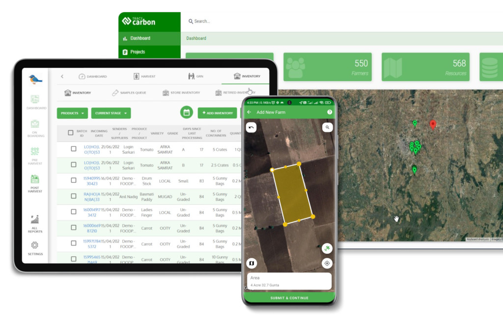
Farm-level geolocation mapping with offline polygon capture and geometry validation before a plot ever reaches a risk check.
Satellite-based screening against Sentinel-2, Landsat, Hansen and JRC layers, with alerts when a sourcing region shows new forest loss.
Agentic AI risk scoring that surfaces the high-risk plots needing mitigation first.
Mitigation workflows and an automated, TRACES-ready DDS with all records centralised for the five-year window.
See it on your own supply chain
Watch satellite plot screening run against your sourcing regions, or take the free EUDR readiness assessment.
What to look for in deforestation risk assessment software
Offline polygon capture for remote smallholder plots, with built-in geometry validation.
Native satellite integration (Sentinel-2, Landsat, Hansen, JRC) with continuous monitoring, not a one-time check.
EUDR-specific risk scoring and mitigation logging, not a generic GIS or ESG module.
Direct TRACES-ready DDS generation with EORI, HS codes and plot geocoordinates.
A centralised five-year audit trail, and proven scale across thousands of smallholders.
Frequently asked questions
What is a deforestation risk assessment under EUDR?
It is a mandatory, evidence-based process that evaluates whether a commodity was produced on land deforested or degraded after 31 December 2020, whether it was produced legally, and whether it traces to specific geolocation. It uses satellite data, land-use records and risk scoring, and its conclusion feeds the DDS.
What counts as negligible risk?
Negligible risk means that, after assessment and any mitigation, the chance of non-compliance is insignificant and you can document how you reached that conclusion. It does not mean zero risk, but it does require a defensible, reproducible methodology rather than a subjective judgement.
How do I map my supply chain for EUDR deforestation risk?
Collect plot-level geolocation for every production plot: GPS points for very small plots and polygon boundaries for plots over 4 hectares. Then screen each plot against satellite datasets, attach legality evidence, and score risk by plot and by sourcing country.
Is a deforestation risk assessment required for every shipment?
Yes. Operators must complete due diligence, including a risk assessment, before placing each regulated batch on the EU market.
Does sourcing from a low-risk country remove the requirement?
No. Even in low-risk countries you must still collect geolocation data and perform due diligence. Country classification affects the depth of checks and the inspection rate, not whether you do the assessment.
Do certifications like FSC or Rainforest Alliance replace it?
No. Certifications can support your evidence and strengthen a risk assessment, but they do not replace the operator’s legal obligation to conduct and document the assessment and file the DDS.
What data do I need for a deforestation risk assessment?
Geospatial data (polygon coordinates, satellite imagery, forest-cover maps), proof of legal land use and tenure, supplier information, and traceability records linking each batch back to its plots.
What happens if risk cannot be classified as negligible?
The product cannot be placed on the EU market until you apply mitigation measures and a reassessment confirms the residual risk is negligible.
What is the EUDR deadline for the risk assessment?
Obligations apply from 30 December 2026 for large and medium operators and 30 June 2027 for micro and small operators. The 31 December 2020 deforestation cut-off is unchanged.
How long must records be kept?
All risk-assessment documentation must be retained for at least five years and be reproducible on request.
Start using TraceX
Transparency, Trust, & Success for your Climate Journey.
We use cookies on our website to give you the most relevant experience by remembering your preferences and repeat visits. By clicking “Accept All”, you consent to the use of ALL the cookies. However, you may visit "Cookie Settings" to provide a controlled consent.
This website uses cookies to improve your experience while you navigate through the website. Out of these, the cookies that are categorized as necessary are stored on your browser as they are essential for the working of basic functionalities of the website. We also use third-party cookies that help us analyze and understand how you use this website. These cookies will be stored in your browser only with your consent. You also have the option to opt-out of these cookies. But opting out of some of these cookies may affect your browsing experience.
Necessary cookies are absolutely essential for the website to function properly. These cookies ensure basic functionalities and security features of the website, anonymously.
Cookie
Duration
Description
cookielawinfo-checkbox-analytics
11 months
This cookie is set by GDPR Cookie Consent plugin. The cookie is used to store the user consent for the cookies in the category "Analytics".
cookielawinfo-checkbox-functional
11 months
The cookie is set by GDPR cookie consent to record the user consent for the cookies in the category "Functional".
cookielawinfo-checkbox-necessary
11 months
This cookie is set by GDPR Cookie Consent plugin. The cookies is used to store the user consent for the cookies in the category "Necessary".
cookielawinfo-checkbox-others
11 months
This cookie is set by GDPR Cookie Consent plugin. The cookie is used to store the user consent for the cookies in the category "Other.
cookielawinfo-checkbox-performance
11 months
This cookie is set by GDPR Cookie Consent plugin. The cookie is used to store the user consent for the cookies in the category "Performance".
viewed_cookie_policy
11 months
The cookie is set by the GDPR Cookie Consent plugin and is used to store whether or not user has consented to the use of cookies. It does not store any personal data.
Functional cookies help to perform certain functionalities like sharing the content of the website on social media platforms, collect feedbacks, and other third-party features.
Performance cookies are used to understand and analyze the key performance indexes of the website which helps in delivering a better user experience for the visitors.
Analytical cookies are used to understand how visitors interact with the website. These cookies help provide information on metrics the number of visitors, bounce rate, traffic source, etc.
Advertisement cookies are used to provide visitors with relevant ads and marketing campaigns. These cookies track visitors across websites and collect information to provide customized ads.
Download the 2026 Traceability Scorecard and Benchmark Your Supply Chain Across 10 Critical Capabilities.
Download our eBook
Don’t Wait for an Audit to Find Your EUDR Gaps
The 2026 Simplification Package changes how HS codes, DDS pass-through and geolocation rules apply to you. Get the free guide and 20-point readiness checklist before enforcement catches you unprepared.