Quick summary: Unlock the potential of agriculture with the power of remote sensing! Discover the importance of remote sensing technology in agriculture, from monitoring crop health, optimizing resource allocation and carbon farming. Enhance your farming practices, maximize yields, and make data-driven decisions for sustainable and efficient crop management.
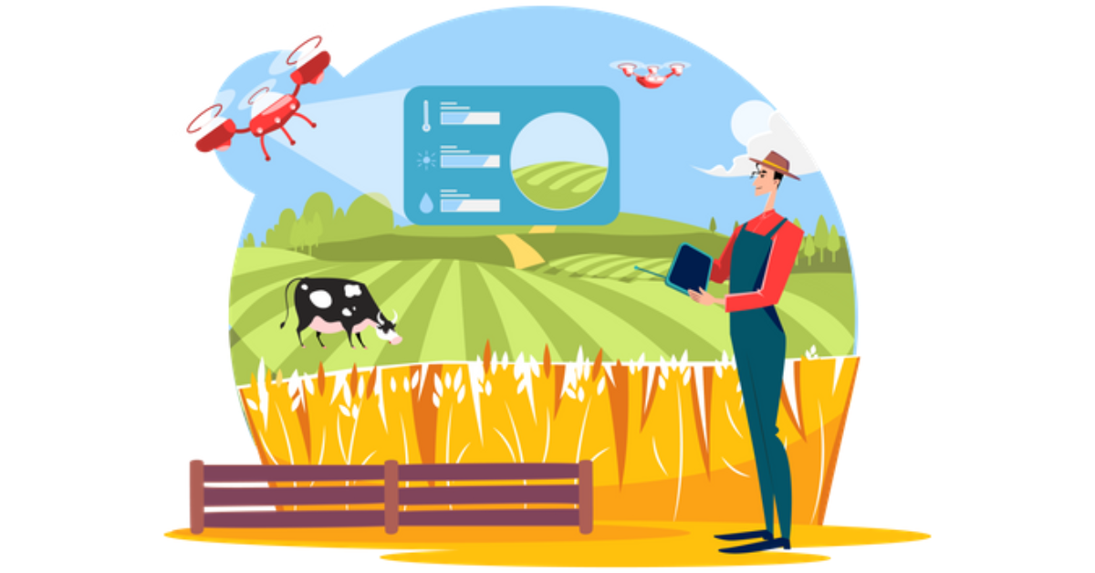
In the world of climate change and resource scarcity, every decision made in agriculture can have far-reaching consequences. Imagine having real-time data on soil moisture, crop health, and weather patterns—right at your fingertips. Remote sensing in agriculture is transforming how farmers manage their crops and resources. Traditional farming methods often rely on guesswork or outdated data, leading to inefficient water use, low crop yields, and financial losses.
Remote sensing addresses this by providing accurate, timely insights, helping farmers optimize their practices, reduce waste, and adapt to environmental changes. As agriculture faces increasing pressure to be more sustainable, remote sensing emerges as a crucial tool for the future. Let us deep dive to understand the applicational aspects of remote sensing by understanding the real world applications of remote sensing and with the outlook towards the future.
Key Takeaways
Remote sensing is a technology that uses sensors to collect data about the Earth’s surface from a distance. In agriculture, remote sensing has become increasingly important as it provides valuable information that can help farmers make informed decisions.
Remote sensing is a game-changer in modern agriculture, providing valuable data that allows farmers to monitor crops, assess soil conditions, and manage resources more efficiently. By using satellite imagery, drones, and other sensors, remote sensing technology captures data from fields without direct contact. This data includes information on soil moisture, crop health, pest infestations, and weather conditions.
There are several types of remote sensing that can be used in agriculture, including:
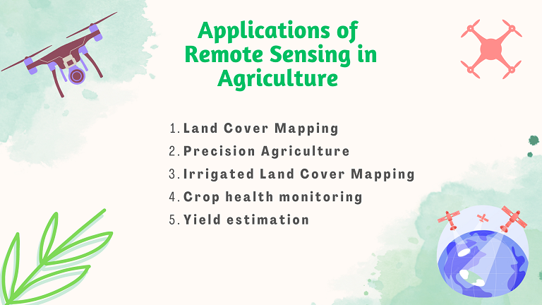
Increasing interest in Remote Sensing and various attempts have been made regarding the study of agriculture using remote sensing. The use of remote sensing in agriculture can range from straightforward tasks like locating fields to complex ones like precision farming. Let’s give a quick look at how remote sensing has helped in agriculture:
The shifts in weather patterns brought on by climate change and global warming endanger crop output. Such changes have an impact on farmers as well as the market for crop insurance because they are difficult to foresee using conventional predictive algorithms. This increases the need for solutions for more accurate risk calculation and damage assessment. Remote sensing has been a breakthrough technology to predict and mitigate these risks.
Agriculture has a compelling role to play in decarbonization, as it has the potential to both emit and capture carbon. At the same time, a shift to more sustainable on-farm practices – and the adoption of technologies that can support these – is enabling farmers to leverage the carbon cycle, removing carbon from the atmosphere and sequestering it in the soil.
Fortunately, technological advancement is remote sensing and satellite imagery are helping farmers and policy makers in understanding the soil carbon stocks. Climate change is also a significant challenge facing the agricultural sector, and remote sensing can play a vital role in monitoring and adapting to changing weather patterns. With the help of remote sensing, farmers can identify areas of the field that are more prone to flooding or drought, allowing them to adjust their crop management practices accordingly.
On one hand where remote sensing is gaining scope in agriculture and has revolutionized the way we work. However, it is important to understand that technology is not infallible, and it has limitations. Few of the limitations of remote sensing have been listed below.
Satellite monitoring enables agribusiness to identify areas with potential nutrient deficiencies or moisture stress, guiding targeted interventions like tailored fertilization and irrigation. This method also allows them to compare satellite data with soil test results to validate findings and ensure data accuracy. By integrating this technology, agribusinesses can improve its land restoration efforts, track the effectiveness of regenerative practices, and optimize resource usage, ultimately supporting more sustainable and productive farming. This data-driven approach helps them not only maintain soil health but also enhance crop yield and quality.
The future of remote sensing in agriculture looks promising, with new advancements and developments being made to enhance the technology’s capabilities. Smart Farming plays a significant role in increasing crop productivity and sustainability, and it is expected to continue doing so in the future. One of the most promising prospects of remote sensing in agriculture is the integration of artificial intelligence (AI) and machine learning (ML) technologies. These technologies can help to automate the analysis of remote sensing data and provide real-time information to farmers. This would enable farmers to make more informed decisions about crop management such as identifying the best time to plant, water, and harvest crops.
TraceX uses remote sensing technology as a critical part of its Farm management platform, enhancing data accuracy and enabling more precise agricultural practices.
1. Monitoring Crop Health: TraceX integrates satellite imagery and drone-based remote sensing to monitor crop health across large agricultural areas. This helps detect variations in plant health, such as areas suffering from water stress, pest infestations, or nutrient deficiencies. By analyzing this data, farmers can take targeted actions to address specific problem areas, improving crop yield and reducing input costs.
2. Soil Moisture Analysis: Remote sensing allows TraceX to provide real-time insights into soil moisture levels. Using data from satellites, the platform helps farmers understand soil conditions and optimize irrigation schedules. This leads to more efficient water use, crucial for water-scarce regions, and ensures that crops receive the right amount of moisture throughout their growth cycle.
A leading agribusiness leveraged TraceX’s platform, incorporating satellite monitoring to enhance soil health assessments as part of their regenerative agriculture practices. By using satellite data, they gained detailed insights into soil conditions, such as moisture levels, organic matter distribution, and nutrient availability across large tracts of farmland. This data allowed the company to precisely monitor soil health in real-time and over different seasons, providing a more accurate understanding of soil trends.
3. Weather and Climate Data Integration: By incorporating remote sensing data on weather patterns and climate conditions, TraceX helps farmers plan their activities more effectively. This data includes insights into rainfall, temperature variations, and potential weather risks, allowing for better preparation and planning during critical farming periods, such as planting and harvesting seasons.
4. Field Mapping and Analysis: TraceX uses remote sensing to create detailed field maps, identifying variations in soil properties and crop conditions across a farm. This helps in implementing precision farming techniques, allowing farmers to apply fertilizers, pesticides, and other inputs more precisely. As a result, resources are used more efficiently, reducing costs and minimizing environmental impact.
5. Yield Prediction and Forecasting: Remote sensing data collected by TraceX aids in analyzing crop growth patterns and predicting potential yields. This helps farmers make more informed decisions about harvesting times and storage, aligning with market demands and maximizing profitability.
By integrating remote sensing data with its blockchain-powered traceability platform, TraceX provides a comprehensive solution for farm management. It not only ensures transparency across the supply chain but also helps farmers adopt data-driven practices for better productivity and sustainability. This approach enables better decision-making, efficient resource management, and improved crop quality, making it a valuable tool for modern agriculture.
Remote sensing in agriculture has become an indispensable tool , enabling farmers to make more informed and precise decisions that can significantly improve productivity and sustainability. By offering insights into crop health, soil moisture, and weather patterns, remote sensing helps optimize resource use and reduce environmental impact. As technology continues to advance, its role in agriculture will only grow, making it crucial for farmers and agribusinesses to integrate these tools into their operations. The future of agriculture lies in the ability to monitor, analyze, and respond to the dynamic challenges of farming with the precision that remote sensing provides.
Remote sensing helps farmers monitor crop health, soil moisture, and weather patterns in real-time, enabling them to make precise decisions. This leads to optimized input use, better yields, and reduced environmental impact.
Remote sensing collects data on various aspects like soil moisture levels, crop health (NDVI), temperature variations, and weather conditions, helping farmers make informed decisions for their fields.
Yes, remote sensing can benefit small-scale farmers by offering affordable options like drone-based imaging and satellite data, allowing them to access critical insights for crop management without significant investment.


