EUDR Plot Data Management: How to Manage Thousands of Farm Polygons at Scale
Published
, 13 minute read
Share this article
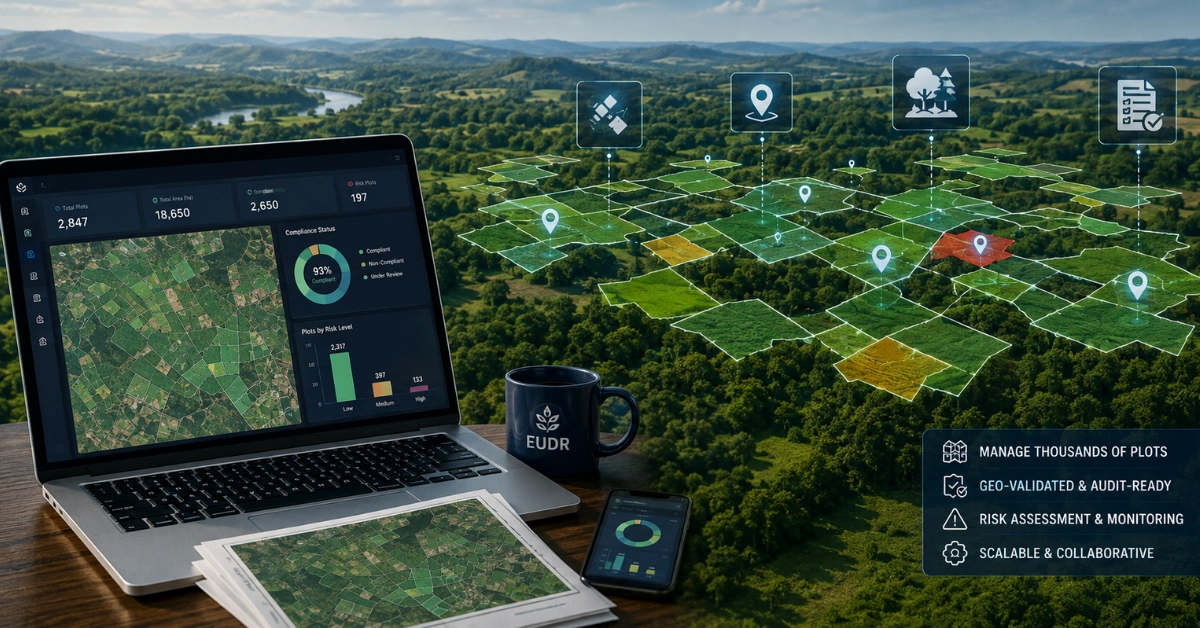
Quick summary: Managing EUDR compliance is rarely about understanding the regulation. It is about handling the sheer volume of plot-level data behind it: hundreds or thousands of farm polygons that each need to stay accurate, validated and connected to the right supplier, commodity and product. This guide breaks down how to build a scalable plot data model, from a central registry through to a submission-ready dataset, so traceability holds up across the full plot to product to DDS chain.
The EUDR Plot Data Managementproblem Is bigger than the map. For companies sourcing coffee, cocoa, rubber, cattle, palm oil, soy and other EUDR-relevant commodities, one of the hardest operational challenges is often not understanding the regulation. It is managing the sheer volume of plot-level information behind it.
A supply chain may involve hundreds or thousands of farms, multiple suppliers, different production regions and changing sourcing relationships. Each relevant plot can carry geolocation information that needs to be connected to the right supplier, commodity, production period, purchase, batch and finished product.
That is why EUDR plot data management should be treated as a core traceability capability not simply a GIS exercise. The challenge is not collecting thousands of polygons once. The challenge is keeping every plot accurate, connected, reviewable and usable throughout the due-diligence process.
Key Takeaways:
EUDR plot data management is more than storing farm polygons. Businesses need to connect geolocation with suppliers, commodities, production periods, batches and relevant products.
Thousands of plots require a structured data model. A central plot registry with unique farmer, supplier and plot identifiers helps reduce duplication and improve traceability.
Geolocation data needs to be validated before submission. Geometry, identifiers, commodity relationships and production information should be checked before they become part of the DDS workflow.
Plot-to-product traceability is critical. Businesses need to demonstrate not only where a commodity was produced, but how that commodity moved through the supply chain and contributed to the relevant product.
Supplier data and plot data must work together. Standardised supplier data collection makes it easier to manage large volumes of farm-level information and identify missing records.
Evidence should remain connected to the plot and supply-chain record. Supporting documents, verification activities and risk decisions should not be maintained as disconnected files.
Plot data needs continuous management. Changes in suppliers, farmers, production periods and sourcing relationships mean plot information should not be treated as a one-time upload.
Automation should scale volume without losing traceability. Bulk processing can help manage thousands of plots, but every record should remain linked to its source, validation status and relevant supply-chain relationships.
EUDR plot data management should be treated as a supply-chain discipline, not just a GIS project. The real value comes from connecting plot → supplier → commodity → batch → product → DDS.
Is Your EUDR GeoJSON Data Ready for Submission?
Validate your farm polygons, identify geometry issues and prepare cleaner geolocation data for your EUDR due-diligence workflow.
EUDR plot data management is the structured process of collecting, storing, validating, updating and connecting the geolocation and related information for land plots where relevant commodities were produced.
Under Article 9 information requirements, operators need the geolocation of all plots where the relevant commodities contained in, or used to make, relevant products were produced, together with the applicable production date or time range. Where a relevant product uses commodities from different plots, the geolocation of all those plots needs to be provided.
The implication is significant: plot information cannot sit separately from the product record. It has to be part of the chain of evidence supporting due diligence.
Why Managing Thousands of Farm Polygons Becomes Difficult
At small scale, a spreadsheet and a folder of map files may appear manageable. At thousands of plots, the same approach can become difficult to control.
Different suppliers may provide geolocation data in different formats.
The same farm may be referenced using different farmer IDs or names.
Coordinates may be incomplete, duplicated or incorrectly associated with a supplier.
Polygon data may need to be linked to products and quantities from different sourcing events.
A single finished product can contain relevant commodities originating from multiple plots.
Plot information can change as supplier relationships, farm records or production periods change.
Compliance teams need to retrieve the evidence and relationships behind a DDS rather than only the map itself.
The problem quickly shifts from mapping to data governance.
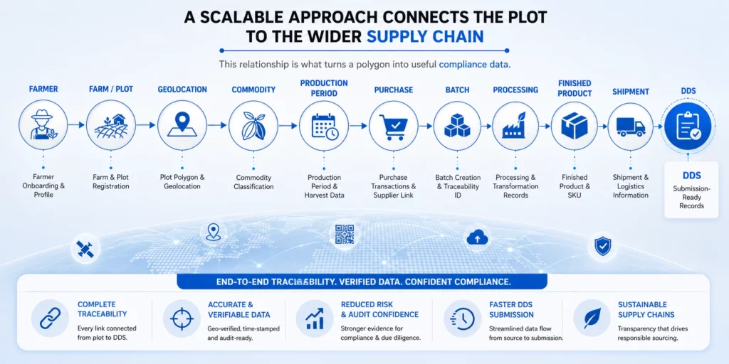
The EUDR Plot Data Chain
A scalable approach should connect the plot to the wider supply chain:
This relationship is what turns a polygon into useful compliance data.
The European Commission’s EUDR Information System allows operators to indicate origins by drawing areas on a map or providing coordinates individually or in bulk. It also supports bulk GeoJSON uploads and an API for managing DDSs or simplified declarations.
The important lesson is that bulk submission capability does not remove the need for strong upstream plot-data management. It makes the quality of the data feeding the process even more important.
1. Build a Central Plot Registry
The first step is to establish a single source of truth for farm and plot records.
Unique farmer or supplier identifier
Unique plot identifier
Geolocation or polygon
Country and production area
Commodity
Production date or time range
Relevant farm attributes
Associated supplier
Status and verification information
Supporting evidence
A central registry reduces duplicate records and makes it easier to understand which plots are active, verified, pending review or no longer relevant.
2. Standardise Geolocation Data
Plot data can arrive from mobile applications, GIS systems, spreadsheets, survey teams, supplier files or other sources. A scalable process should standardise how the information is stored and validated before it becomes part of a due-diligence record.
The Commission’s Information System supports GeoJSON for bulk location information, and the Commission provides tools and guidance for common technical issues related to GeoJSON files.
This makes data preparation important. A business should know which coordinate system, geometry format, identifiers and supporting metadata are being used before attempting bulk transfer.
Understand what geolocation data EUDR requires, how to manage farm polygons and coordinates, and how to prepare accurate, traceable plot data for due diligence.
Plot data should pass validation rules before it is used for a compliance submission.
Is the geometry present and readable?
Is the plot linked to a known farmer or supplier?
Is the commodity correctly identified?
Is the production period available?
Is the plot duplicated?
Does the plot have the required supporting evidence?
Does the plot have an appropriate review or verification status?
Validation should happen upstream. Finding a missing polygon while preparing a shipment is much more expensive than identifying it when the supplier record is first created.
Learn how geometry validation can help identify invalid or incomplete polygons, improve geolocation data quality and strengthen your EUDR due-diligence process.
One of the most important principles of EUDR plot data management is that a plot cannot be treated as an isolated GIS object.
The business needs to understand how commodities from the plot enter the supply chain and contribute to relevant products. The Commission’s guidance confirms that the geolocation of all relevant production plots needs to be included when a product contains commodities produced on different plots.
This is why plot-to-batch and plot-to-product relationships matter. They allow teams to move from “this farm exists” to “this farm contributed to this relevant product.”
5. Manage Plot Data at Supplier Scale
Supplier engagement becomes critical when managing thousands of plots.
Instead of requesting unstructured files every time, businesses can establish standard data templates, identifiers and submission workflows. Suppliers or field teams can provide plot information through controlled processes, while internal teams can review and approve the records.
The objective is to make the supplier the source of information not the owner of the company’s final compliance record.
How Can Soy Traders Scale EUDR Compliance Without Slowing Operations?Discover how a leading Nigerian commodity trader leveraged AI-powered traceability with TraceX to strengthen soy traceability, support deforestation-free sourcing and prepare for evolving EU regulatory requirements.
A plot polygon tells you where production occurred. It does not, by itself, establish every element of due diligence.
EUDR requires operators to collect information such as supplier details, product information, quantity, country of production, geolocation and evidence that relevant products are deforestation-free and legally produced.
A scalable plot record should therefore be able to connect relevant documents, declarations, assessments and verification activities to the plot or the associated supply-chain record.
7. Build Risk Review Into Plot Management
Plot management and risk management should not be separate workflows.
If a plot is associated with missing information, a potential concern or an identified risk, the record should be capable of moving into a review or mitigation workflow.
The European Commission describes EUDR due diligence as a three-step process: collect information, assess risk and, where necessary, mitigate risk. Operators must reach no or negligible risk before placing relevant products on the EU market or exporting them.
A plot registry therefore becomes more valuable when it supports the full path from data collection to risk decision.
8. Design for Change, Not a One-Time Data Upload
Farm data is not necessarily static.
Suppliers can change. Farmer records can change. Production periods change. Sourcing relationships change. New plots can enter the supply chain.
The due-diligence system must also be updated when anything important changes and reviewed at least annually, according to the Commission’s current implementation guidance. Records related to due diligence must be kept for five years.
This makes versioning, status management and audit history important components of scalable EUDR plot data management.
9. Use Bulk Processing Without Losing Traceability
When a company manages thousands of plots, manual entry is not a realistic long-term operating model.
The EUDR Information System supports bulk provision of location information using GeoJSON, and it also provides an API for bulk management of DDSs or simplified declarations.
But automation should not mean losing control. Every bulk-imported record should still be traceable to its source, validation status and relevant supply-chain relationships.
The right principle is: automate the volume, preserve the evidence.
10. Create a Submission-Ready Plot Dataset
Before a DDS is prepared, compliance teams should be able to generate a clean view of the plots supporting a relevant product.
A submission-ready dataset should answer:
Which plots produced the relevant commodity?
Who supplied the commodity?
Where are the plots located?
What commodity was produced?
What production period applies?
Which product, batch or shipment is linked to those plots?
What evidence supports the due-diligence decision?
Which plots require additional review?
This turns plot management into an operational compliance process rather than a last-minute mapping exercise.
Learn what you need to prepare before filing your DDS, from supplier and geolocation data to risk assessment, supporting evidence and submission-ready records.
How TraceX Can Help With EUDR Plot Data Management
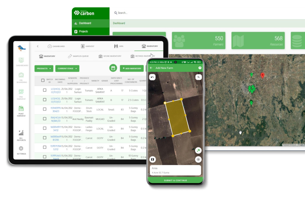
TraceX can help organisations manage EUDR plot data as part of a broader digital traceability workflow. Instead of treating geolocation as a standalone map layer, TraceX EUDR Solutions can connect farmer and supplier records with plots, production activities, commodities, transactions, batches, supporting evidence and compliance workflows.
Centralise farmer, supplier and plot information.
Capture and manage plot geolocation as part of the traceability record.
Assign consistent identifiers across farmers, plots and supply-chain transactions.
Connect plots with commodities, production activities, batches and products.
Link supporting evidence to relevant records.
Support risk assessment and mitigation workflows.
Provide a structured foundation for EUDR due-diligence preparation.
Maintain traceability as sourcing and plot information changes.
The goal is not simply to store thousands of polygons. It is to make those polygons usable, connected and auditable within the wider supply chain.
Ready to Simplify EUDR Compliance?
See how TraceX can help you connect supplier data, farm plots, geolocation, risk assessment, traceability and DDS preparation in one digital workflow.
A company can have 50,000 polygons and still have poor EUDR traceability.
Why? Because volume is not the real measure of readiness.
The real question is whether every plot can be connected to the right supplier, commodity, production period, transaction and relevant product and whether the business can explain what happened to that information during due diligence.
EUDR plot data management should be treated as a supply-chain data discipline, not a GIS project.
GIS tells you where the plot is. Traceability tells you what that plot means in the context of the product moving through the supply chain.
Collect plot data. Standardise the format and identifiers. Validate the geometry and attributes. Connect plots to commodities and products. Assess risk. Approve or escalate records. Trace the plot through transactions and batches. Use the validated dataset for DDS preparation. Retain the supporting record.
Conclusion
Managing thousands of farm polygons for EUDR is not simply a question of collecting more maps. It requires a system that can turn location data into traceable supply-chain evidence.
Businesses that build a central plot registry, standardise geolocation, validate records, connect plots to products and batches, manage evidence and integrate risk workflows can move closer to a scalable EUDR operating model.
The future-ready approach is clear: don’t just manage polygons. Manage the relationships behind them.
If your EUDR programme involves thousands of farms, suppliers and plots, the right digital foundation can make the difference between continuously chasing data and having a traceable record ready when compliance requires it.
Frequently Asked Questions (FAQ’s)
What is EUDR plot data management?
EUDR plot data management is the process of collecting, validating, organising and connecting the geolocation and related information for plots where relevant EUDR commodities were produced.
Does EUDR require geolocation for every relevant plot?
The Commission states that operators need the geolocation of all plots where the relevant commodity contained in, or used to make, a relevant product was produced, together with the applicable production date or time range. Where commodities come from different plots, all relevant plots need to be included.
Can thousands of EUDR plot polygons be uploaded in bulk?
The EUDR Information System supports bulk provision of location information using GeoJSON, and it also provides an API for bulk management of DDSs or simplified declarations
How should businesses validate EUDR plot data?
Businesses should validate geometry, identifiers, supplier and commodity relationships, production-period information and relevant evidence before using the plot data in due-diligence workflows.
How does plot data support EUDR due diligence?
Plot data forms a core part of the Article 9 information requirements and helps connect the relevant commodity to its production origin. It should be managed alongside supplier, product, quantity, legality, deforestation-free evidence and risk-assessment information.
How long should EUDR due-diligence records be retained?
The European Commission’s current implementation guidance states that documents related to due diligence must be kept for five years from the date the product is placed on the EU market or exported.
Start using TraceX
Transparency, Trust, & Success for your Climate Journey.
We use cookies on our website to give you the most relevant experience by remembering your preferences and repeat visits. By clicking “Accept All”, you consent to the use of ALL the cookies. However, you may visit "Cookie Settings" to provide a controlled consent.
This website uses cookies to improve your experience while you navigate through the website. Out of these, the cookies that are categorized as necessary are stored on your browser as they are essential for the working of basic functionalities of the website. We also use third-party cookies that help us analyze and understand how you use this website. These cookies will be stored in your browser only with your consent. You also have the option to opt-out of these cookies. But opting out of some of these cookies may affect your browsing experience.
Necessary cookies are absolutely essential for the website to function properly. These cookies ensure basic functionalities and security features of the website, anonymously.
Cookie
Duration
Description
cookielawinfo-checkbox-analytics
11 months
This cookie is set by GDPR Cookie Consent plugin. The cookie is used to store the user consent for the cookies in the category "Analytics".
cookielawinfo-checkbox-functional
11 months
The cookie is set by GDPR cookie consent to record the user consent for the cookies in the category "Functional".
cookielawinfo-checkbox-necessary
11 months
This cookie is set by GDPR Cookie Consent plugin. The cookies is used to store the user consent for the cookies in the category "Necessary".
cookielawinfo-checkbox-others
11 months
This cookie is set by GDPR Cookie Consent plugin. The cookie is used to store the user consent for the cookies in the category "Other.
cookielawinfo-checkbox-performance
11 months
This cookie is set by GDPR Cookie Consent plugin. The cookie is used to store the user consent for the cookies in the category "Performance".
viewed_cookie_policy
11 months
The cookie is set by the GDPR Cookie Consent plugin and is used to store whether or not user has consented to the use of cookies. It does not store any personal data.
Functional cookies help to perform certain functionalities like sharing the content of the website on social media platforms, collect feedbacks, and other third-party features.
Performance cookies are used to understand and analyze the key performance indexes of the website which helps in delivering a better user experience for the visitors.
Analytical cookies are used to understand how visitors interact with the website. These cookies help provide information on metrics the number of visitors, bounce rate, traffic source, etc.
Advertisement cookies are used to provide visitors with relevant ads and marketing campaigns. These cookies track visitors across websites and collect information to provide customized ads.
Download the 2026 Traceability Scorecard and Benchmark Your Supply Chain Across 10 Critical Capabilities.
Download our eBook
Don’t Wait for an Audit to Find Your EUDR Gaps
The 2026 Simplification Package changes how HS codes, DDS pass-through and geolocation rules apply to you. Get the free guide and 20-point readiness checklist before enforcement catches you unprepared.