Contact: +91 99725 24322 |
Menu
Menu
Quick summary: Discover the critical role of geolocation in meeting EUDR compliance. Learn how accurate geolocation data safeguards your business from penalties and enhances sustainability.

The EU Deforestation Regulation (EUDR) represents a major shift in how businesses must manage and report their environmental impacts. EUDR Geolocation is one of the many challenges companies face today. Geolocation, which involves creating and maintaining detailed geographical data, is not just a regulatory hurdle but a crucial aspect of ensuring transparency and compliance. However, many companies struggle with the complexity and precision needed for accurate geomapping, risking non-compliance and potential penalties.
For plots of land smaller than 4 hectares and for cattle establishments, a single geolocation point (one latitude and one longitude coordinate) is sufficient. However, for plots larger than 4 hectares used to produce relevant commodities other than cattle, polygons with enough points to accurately outline the perimeter of the land are required.
Geolocation plays a critical role in ensuring supply chain traceability under the European Union Deforestation Regulation (EUDR). EUDR mandates that businesses prove their products are not linked to deforestation, and this proof hinges on accurate geolocation data. By capturing the exact coordinates of the land where commodities are produced, companies can create a clear, verifiable trail that traces the journey of products from farm to market.
Geolocation data enables companies to map out every plot of land involved in their supply chain. This mapping is crucial for demonstrating compliance with EUDR requirements, as it allows companies to pinpoint the origin of each product and confirm that it comes from deforestation-free areas. Additionally, geolocation enhances supply chain transparency, giving businesses the ability to track and report on the environmental impact of their sourcing practices with precision.
In the context of EUDR, geolocation is not just a technical requirement—it’s a key element of traceability that helps businesses avoid regulatory penalties, meet sustainability goals, and maintain trust with consumers and stakeholders.
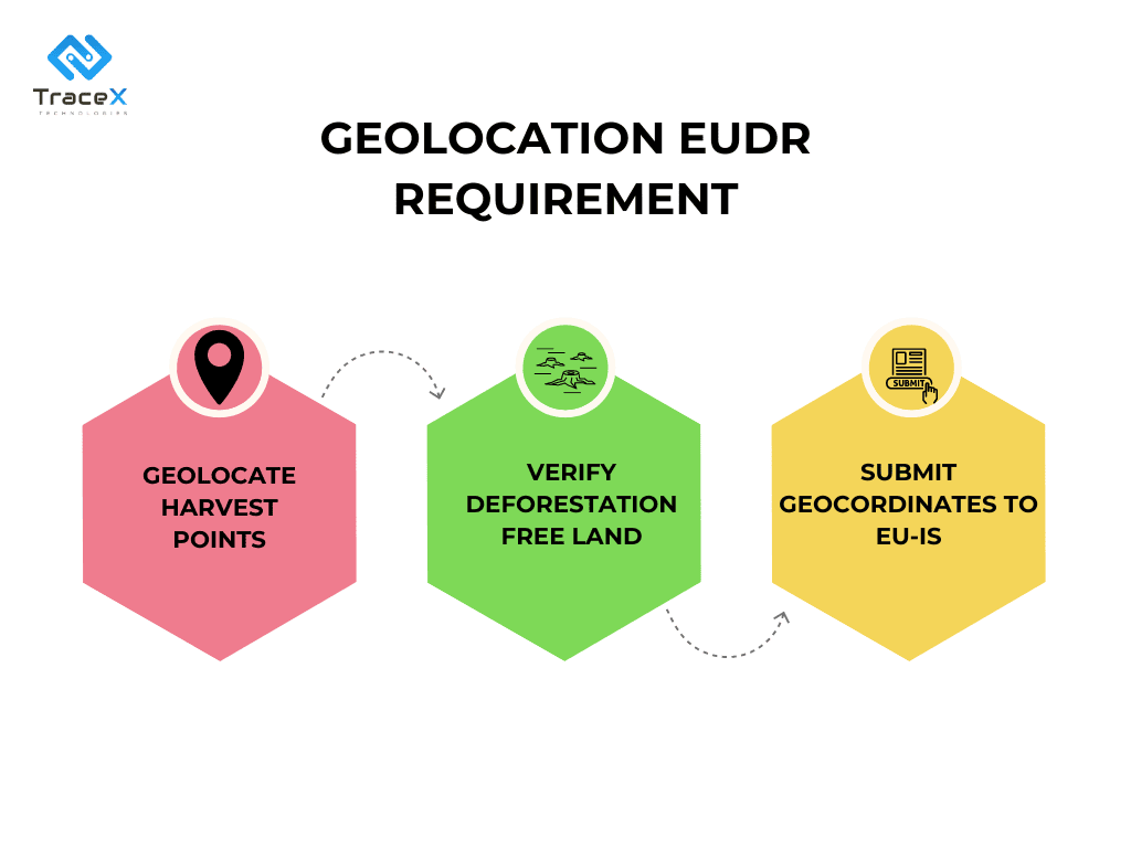
The EUDR mandates that companies conduct due diligence on the origin of all forest-risk commodities. This involves collecting geolocation coordinates for all land where these commodities are produced. Depending on the size of the plot, geolocation data may be provided as GPS coordinates or polygons.
Geolocation Coordinates: Companies must gather geographical coordinates, including latitude and longitude, for all land where relevant commodities are produced. These coordinates should be accurate to at least six decimal places.
Polygons for Larger Plots: For plots of land larger than 4 hectares, geolocation data must be provided using polygons, with enough latitude and longitude points to accurately outline the land’s perimeter.
The EU Deforestation Regulation (EUDR) sets out specific geomapping obligations to ensure that products placed on the EU market do not contribute to deforestation or forest degradation. These obligations require businesses to:
1. Document Land Use: Maintain detailed records of land use for areas where products are sourced.
2. Provide Accurate Maps: Create and maintain up-to-date maps that reflect the geographical and environmental conditions of the land involved in the supply chain.
3. Ensure Data Integrity: Guarantee that the data used in geomapping is accurate, verifiable, and complete.
To meet EUDR requirements, businesses must focus on the following key components:

The EUDR mandates that geomapping data be regularly updated to reflect current conditions accurately. Geomapping records should be updated periodically, as well as whenever significant changes occur in land use or environmental conditions. Regular updates ensure that the data remains relevant and accurate. The accuracy of geomapping data is crucial for compliance. Businesses must use reliable data sources and technologies to ensure that maps and records accurately represent land use and environmental impacts.
Operators and traders, excluding SMEs, are required under the EUDR to collect and submit geographic coordinates of the land plots where commodities are produced. This traceability ensures that the products are not linked to deforestation. Geographic information, such as satellite images or geotagged photos, is vital for verifying compliance. These coordinates must be included in due diligence statements submitted to the Information System before products can be placed on the market or exported. Coordinates can be collected using mobile phones, GNSS devices, or GIS applications. For plots over 4 hectares, geolocation must be provided using polygons, while smaller plots or cattle establishments can be described with a single coordinate point.
Operators can use geolocation data provided by producers, but they are ultimately responsible for its accuracy. The EUDR does not apply to producers (e.g., smallholders) who do not directly place products on the EU market. Operators must ensure the correct mapping of the production area and verify that the geolocation data corresponds to the actual plot of land. This may involve risk assessment procedures, including capacity building and support for smallholders to meet the Regulation’s requirements.
Operators and non-SME traders must verify and ensure the accuracy of geolocation data. Providing incorrect geolocation information would breach their obligations under the Regulation. Polygons must be used to outline the perimeter of each individual plot of land where a commodity is produced. Each polygon should represent a single plot, whether contiguous or not. If a product involves multiple plots, several polygons must be included in the due diligence statement. Polygons cannot cover random areas that only partially include the relevant plots. For plots over four hectares, geolocation must be provided using polygons, not a central point with a circumference.
Geographic Information Systems (GIS) are powerful tools designed for capturing, storing, analyzing, and managing spatial and geographic data. GIS integrates various types of data to create detailed maps and conduct complex spatial analyses. Key capabilities include combining data from multiple sources (e.g., satellite images, land surveys) to create comprehensive maps, performing analysis on spatial relationships, patterns, and trends (e.g., land use changes, deforestation rates) and generating detailed and interactive maps that visually represent geographic data and trends.
Satellite imagery involves capturing high-resolution images of the Earth’s surface from space. It provides a broad view of large areas, making it useful for monitoring extensive landscapes and detecting changes in land use. Modern satellites offer high-resolution imagery that can detect small-scale changes in land use, helping to identify deforestation or other environmental impacts.
Drones and aerial surveys use unmanned aerial vehicles (UAVs) or aircraft to capture detailed images and data from the air. Drones can capture high-resolution, detailed images of specific areas, offering precise data on land use and vegetation. Drones are adaptable for various surveying needs, including hard-to-reach or remote areas where traditional methods might be challenging.
Real-time data collection involves using technologies to gather and analyze data as it is generated. This enables the monitoring of land use and environmental conditions in real-time, providing up-to-date information for compliance checks. It allows for the rapid analysis of data to detect changes or anomalies promptly, ensuring timely responses to potential compliance issues.
Mapping software can be integrated with compliance tools to enhance EUDR adherence. It ensures that geomapping data is synchronized with compliance databases and systems, maintaining consistency across platforms. It facilitates the automated generation of compliance reports based on geomapping data, streamlining the reporting process. It also combines geomapping data with compliance analytics to provide insights into land use practices and potential compliance issues.
The European Commission has recently published the interface details for submitting due diligence statements under the EU Deforestation Regulation through the Information System. A key aspect of this submission is the proper formatting and storage of geolocation data of farm plots.
GeoJSON Format- GeoJSON is used for encoding geographic data, structured based on JavaScript Object Notation (JSON). It includes a “geometry” that describes the shape of the geographic feature (such as a point or polygon) and “properties” that contain non-spatial attributes.
Coordinates must be in decimal degrees format:
– Latitude: Between -90 and +90.
– Longitude: Between -180 and +180.
The order of coordinates should be longitude first, followed by latitude. This standardized format ensures that the geolocation data can be accurately stored and processed within the TRACES system, facilitating compliance with the EUDR.
Polygons must consist of at least 4 non-aligned points. It should not have intersections between their sides to maintain accuracy and integrity. Geographical point coordinates must be precise, depicted with at least six decimal places.
Each DDS is limited to 25 MB, which equates to approximately 30,000 to 40,000 points or polygons per file. GeoJSON format, though required, is not memory-efficient and can result in double the file size compared to other formats like Shapefile or Geopackage.
These guidelines are crucial for ensuring that geospatial data submitted under the EUDR is both accurate and compliant, despite the file size challenges presented by the GeoJSON format.
Latitude and longitude coordinates can be recorded using various coordinate reference systems (e.g., UTM, WGS, Lambert, etc.). These coordinates can be stored in different file formats (e.g., CSV, Shapefiles, KML, GeoJSON, etc.) and managed or visualized through various software or platforms (e.g., Google Earth, ArcGIS, QGIS, etc.).
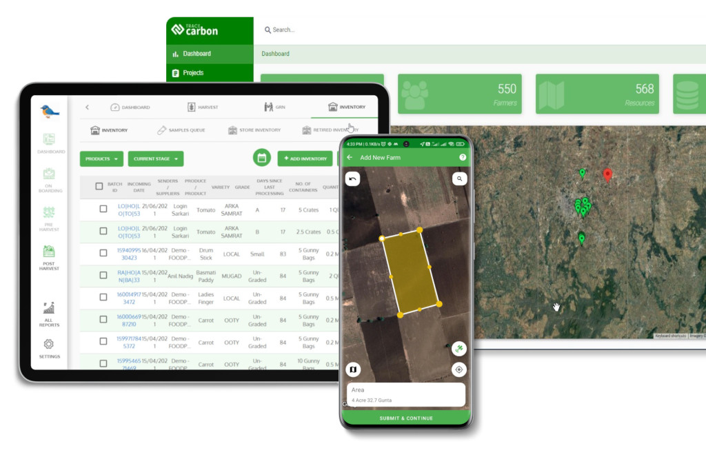
The TraceX EUDR Compliance Platform is designed to meet the stringent geolocation requirements of the EUDR by offering robust tools for identifying and managing non-compliance risks. It enables operators to pinpoint plot areas that may not meet deforestation-free criteria, ensuring alignment with EUDR mandates. By cross-referencing activity data with known commodity plantations, the platform verifies the accuracy of land use assertions, reducing the risk of non-compliance. Additionally, it assesses regulatory adherence by identifying plots within protected areas or indigenous territories. The platform also conducts detailed perimeter analyses to evaluate deforestation risks beyond plot boundaries and tracks local deforestation trends, helping companies gauge and mitigate potential risks effectively. Through these capabilities, TraceX ensures that all geolocation data collected is precise, comprehensive, and compliant with EUDR requirements, safeguarding businesses from penalties and enhancing their sustainability credentials.
As the EUDR sets rigorous standards for traceability and sustainability, geolocation has emerged as a cornerstone of compliance. Accurate and detailed geolocation data ensures that commodities meet deforestation-free requirements, safeguarding businesses from penalties while bolstering their environmental responsibility. By leveraging advanced technologies and adhering to precise geolocation protocols, companies can not only fulfill regulatory obligations but also strengthen their market position and reputation in an increasingly eco-conscious world. Embracing geolocation is not just about compliance—it’s about leading the way in sustainable and responsible sourcing.
